
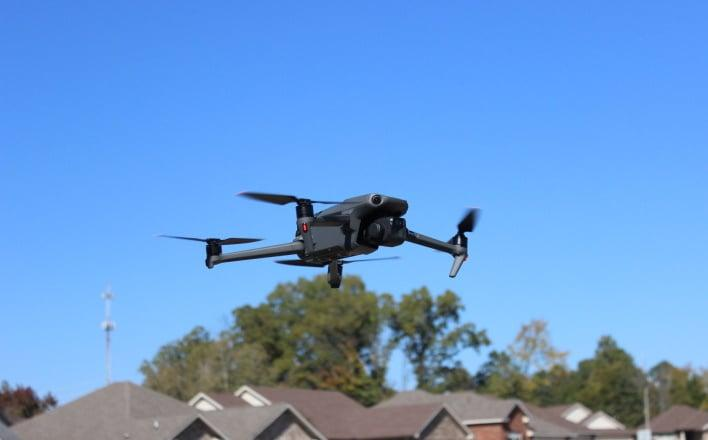
A New Era for Public Safety Technology
When an emergency call comes in, every second matters. A fire may be spreading through a residential neighborhood, a traffic collision may block several lanes of a busy highway, or a missing person may be somewhere in a wooded area after sunset. Traditionally, emergency responders have relied on dispatch information, eyewitness reports, ground patrols, and helicopters to understand what is happening. Today, camera-equipped drones are becoming another important tool in the American public safety system.
Across the United States, police departments and other public agencies are exploring ways to deploy unmanned aircraft before personnel reach an incident. The concept, commonly known as Drone as First Responder, allows a drone to provide an aerial view of a situation while officers, firefighters, or emergency managers prepare their response. The goal is not to replace human responders but to give them useful information sooner.
The technology is gaining attention because it combines relatively compact aircraft, high-resolution cameras, thermal imaging, wireless communications, and increasingly sophisticated flight-control systems. Yet its growth also raises important questions about privacy, safety, cost, and the reliability of the equipment that keeps these aircraft in the air.
Why American Cities Are Turning to Drones
One of the biggest advantages of a drone is its ability to reach a location without getting caught in traffic. During a major collision, for example, emergency vehicles may struggle to navigate crowded streets while dispatchers receive conflicting reports about the number of vehicles involved or the condition of the roadway.
A drone can provide an overhead view that helps responders identify blocked lanes, assess hazards, and determine where assistance is most urgently needed. Fire departments may use aerial footage to examine a building’s roof, observe the spread of smoke, or identify dangerous areas that crews should avoid.
In September 2026, Bellevue, Washington, announced a one-year pilot program designed to expand the use of unmanned aircraft in emergency response. The initiative allows drones to be deployed in connection with police incidents and at the request of the fire department. Los Angeles has also moved beyond a trial phase, establishing a dedicated Drone as First Responder unit in August 2026. These developments illustrate how aerial technology is becoming part of broader discussions about municipal services and public safety.
For city officials, the appeal is straightforward. An aerial perspective can help emergency teams make better-informed decisions before committing personnel and resources. However, the value of a drone depends on how reliably it can launch, reach the scene, transmit useful images, and operate within the limits of its equipment.
How Camera Technology Improves Emergency Decisions
Modern public safety drones can carry more than a basic camera. Depending on the aircraft, they may include optical zoom, thermal imaging, obstacle avoidance, positioning systems, and encrypted communication links.
These capabilities can make a meaningful difference during search-and-rescue operations. If a person is missing in a park or a remote area, a thermal camera may help trained operators identify a heat signature that would be difficult to see from the ground. Thermal imagery is not infallible, however. Weather, vegetation, terrain, and other heat sources can affect what the camera detects, so ground teams must verify the information before acting on it.
High-resolution cameras can also help incident commanders understand the layout of a scene. After a severe storm, a drone may document damaged rooftops, fallen trees, flooded roads, or inaccessible sections of a neighborhood. Emergency management teams can use this information to prioritize inspections and determine which routes remain passable.
In some situations, drones can reduce the need to send people into dangerous locations before the risks are understood. Aerial footage may reveal unstable structures, hazardous debris, or an approaching fire front. The aircraft does not eliminate the danger, but it can provide another layer of situational awareness.
The most useful systems are those that fit into established emergency procedures. A drone’s images need to reach the right people, be interpreted correctly, and support decisions that can be carried out safely on the ground.
The Hidden Challenge of Flight Time and Power
Advanced cameras and communication equipment are valuable only when a drone has enough power to perform its mission. Flight time affects how far an aircraft can travel, how long it can observe an incident, and whether it can remain airborne while responders coordinate their next steps.
A drone battery must supply power to several systems at once, including the motors, flight controller, navigation hardware, camera, and wireless equipment. Demanding flight conditions can increase energy consumption, particularly when the aircraft faces strong winds, carries additional equipment, or performs repeated climbs and directional changes.
For public safety agencies, this makes battery management an operational issue rather than a minor technical detail. A drone that reports a low charge during a critical mission may need to return immediately, potentially interrupting aerial observation at an inconvenient moment.
Departments can reduce this risk through scheduled charging, preflight checks, spare aircraft, and clearly defined return-to-home procedures. They also need to account for temperature, battery age, storage conditions, and the difference between advertised flight time and actual performance in the field.
Repeated deployments create another challenge. A drone may be technically ready to fly after landing, but its power system may require time to recharge before the next mission. Agencies considering automated launch stations must therefore plan for charging capacity, equipment rotation, maintenance, and backup arrangements.
Reliable power is particularly important when a drone is expected to respond quickly to successive calls. The system must be ready not only for its first flight but also for the unpredictable demands of an entire shift.
AI and Automated Launch Systems Are Changing the Workflow
Another development attracting attention is the integration of drones with automated launch stations and emergency dispatch systems. Instead of manually transporting an aircraft to every incident, an authorized operator may be able to launch a drone from a designated station and guide it toward the reported location.
Depending on the system and the approvals under which it operates, portions of the flight may be automated. The aircraft can follow a planned route, avoid certain obstacles, transmit live video, and return to its station when the mission ends.
Artificial intelligence may also help operators organize visual information. Software can assist with identifying objects, highlighting movement, or prioritizing video feeds. These tools can reduce the burden of monitoring multiple information sources, but they should not be treated as infallible decision-makers.
A system that misidentifies a person, overlooks an obstacle, or interprets an image incorrectly could lead to a poor operational decision. Human oversight, clear operating rules, and regular testing remain essential.
Automation also introduces cybersecurity considerations. Public safety agencies need to protect flight-control systems, communication links, and stored footage from unauthorized access. A drone is not simply a camera in the sky; it is a connected device that can affect real-world operations if its systems fail or are compromised.
Privacy Concerns Are Growing Alongside Adoption
The expansion of public safety drones has generated a difficult debate about how communities should balance rapid emergency response with individual privacy.
Supporters argue that aerial footage can help officers assess dangerous situations, find missing people, and avoid unnecessary deployments. Critics worry that drones equipped with powerful cameras could record people who are not involved in an emergency or contribute to broader surveillance networks.
The distinction between a targeted emergency flight and routine observation matters. A drone sent to locate a person after a 911 call presents a different privacy question from one that repeatedly monitors a neighborhood without a clearly defined purpose.
Los Angeles has published information about its Drone as First Responder operations, including policies addressing privacy and the handling of recordings. Such transparency measures can help residents understand when drones may be deployed and what restrictions govern their use.
Communities can also benefit from publicly available operating policies, retention schedules, complaint procedures, and regular reports on how often drones are used. Independent oversight may help ensure that aerial technology remains focused on legitimate public safety objectives.
Clear rules are especially important as camera systems become more capable. High-resolution zoom and thermal imaging can reveal information that people may not expect to be collected from above. Responsible deployment requires agencies to consider not only what technology can do but also what it should be permitted to do.
Weather, Maintenance, and Equipment Reliability
Emergency situations rarely happen under ideal conditions. Heavy rain, gusty winds, smoke, poor visibility, and extreme temperatures can complicate drone operations. Even when an aircraft is rated for certain environmental conditions, agencies must follow the manufacturer’s operating limits and their own safety procedures.
Maintenance is equally important. Motors, propellers, sensors, landing equipment, and communication components need routine inspection. A small defect that goes unnoticed during a normal recreational flight could have serious consequences when a drone is operating above a crowded street or near emergency crews.
Battery care deserves particular attention. A drone battery that has aged, been stored incorrectly, or suffered physical damage may not deliver the expected performance. Agencies should follow manufacturer guidance for charging and storage, monitor battery health, and remove questionable units from service rather than relying on optimistic estimates of remaining flight time.
Training is another essential part of reliability. Operators need to understand navigation, airspace restrictions, emergency procedures, and the limitations of camera systems. They must also know when not to fly. If weather conditions or equipment problems make an operation unsafe, delaying a launch may be the most responsible decision.
The Federal Aviation Administration provides guidance for public safety organizations operating unmanned aircraft. Agencies must determine which regulatory framework applies to their operations and secure the necessary authorizations where required. Effective programs combine compliant flight procedures with practical training and ongoing risk assessment.
Are Drones More Cost-Effective Than Helicopters?
Cost is one reason cities are examining drones as a complement to traditional aviation. Helicopters can cover large areas and carry specialized equipment, but they also require significant resources for pilots, maintenance, fuel, storage, and operations.
Small drones may provide a more economical way to obtain aerial information for certain incidents. A city might use one to check a traffic collision, inspect a storm-damaged road, or assess a localized emergency without automatically requesting a helicopter.
However, a drone program is not free. The total cost can include aircraft, cameras, automated launch stations, software subscriptions, operator training, repairs, communications infrastructure, and data storage. Agencies also need contingency plans for equipment failure and periods when aircraft are unavailable.
A realistic financial assessment should compare the entire operating model rather than the purchase price of a drone with the cost of a helicopter. The best solution may involve using drones for routine, localized assessments while reserving helicopters and crewed aircraft for missions that require greater endurance, range, or specialized capabilities.
Public agencies should also evaluate measurable outcomes. Did the drone help responders reach a decision sooner? Did it improve the safety of personnel? Did it reduce unnecessary dispatches or provide useful information during a disaster? Transparent evaluation can help taxpayers understand whether a program delivers sufficient value.
What the Future Holds for Emergency Response Drones
Over the next several years, camera drones are likely to become more integrated with emergency communications, mapping tools, and municipal technology systems. Improvements in imaging, flight control, and energy management could make them more useful for longer or more complex missions.
Battery innovation may contribute to better endurance, while improved charging systems could help agencies maintain readiness between flights. Nevertheless, no single hardware improvement will solve every operational problem. Weather, communication coverage, airspace restrictions, staffing, and public trust will continue to influence how drones are used.
The broader trend is clear: American cities are exploring ways to get better information to emergency responders before they arrive at a scene. Drones can help bridge that gap, but their success will depend on thoughtful integration with existing services.
For residents, the most important question is not whether every emergency should involve a drone. It is whether a particular deployment improves safety, respects privacy, and provides information that responders can use responsibly.
For public safety agencies, dependable equipment, clear policies, and ongoing training will matter as much as impressive camera specifications. A well-designed program must be ready for routine calls as well as unexpected crises, without compromising the rights of the community it serves.
As these systems become more common, the drone battery will remain one part of a much larger operational equation. Reliable power, responsible data practices, capable operators, and public accountability must work together.
The future of emergency response will not be defined by flying cameras alone. It will be shaped by how effectively communities combine new technology with sound judgment, transparent oversight, and the fundamental goal of protecting lives.
